The latest updates in the Rural Sector, our upcoming PearGIS updates and some of our upcoming ventures for the year.
What’s new in the rural sector?
2023 Is proving to be an interesting time for the rural sector!
In the UK, the rural sector is undergoing significant changes. Things were shaken up when the government announced it would be making staggered changes to the programmes under the Environmental Land Management Schemes (ELMS). Now, the Sustainable Farming Incentive, Local Nature Recovery, Countryside Stewardship Scheme and Landscape Recovery schemes are all the talk of the industry, as landowners and estate managers work to understand which programmes their land is eligible for, and what they need to do to apply for the schemes.
The revised government programmes have presented some newly-faced challenges for many of our customers to tackle, and we have been taking the time to gain more insight into the various ways people are adapting to these changes. Given that the primary focus and driving force behind our products is to facilitate the key working tasks of our customers, we have been keen to explore how we can adapt our software to best help our customers’ ever-changing needs in this new landscape.
At events and conferences up and down the UK, we have been learning about how companies and landowners are tackling the ELMS changes head on. We have listened as customers have explained the new functionality they now need from us and our programmes. We’ve been hard at work improving our PearGIS software to provide this requested functionality, with the goal of assisting in the mapping needs for our clients who are applying to new schemes, or working hard to decipher which scheme is suitable for their client’s land. The ELMS-inspired updates are now due to be rolled out to our customers very shortly — keep an eye on our social media pages for updates!
Upcoming PearGIS updates
Some of our customers may not be aware that we have been undergoing a staggered release of our new software, PearGIS, which is the upgrade to MapLink and PTMapper. This soft launch has intentionally gone a little under the radar, as we’ve wanted to make sure that everything works the way our customers need it to before sending it out to the masses. The good news is that with these new updates, we will also be fully releasing PearGIS and making it available to the rest of our rural-sector customers! We’ll be staggering this release in order to manage volumes and provide any requested training, so look out for an email from us soon with more information if you’ve not yet got your hands on PearGIS.
So, onto the updates. What new functionality can you expect with the upcoming PearGIS changes? We have a huge amount of new features which are due to be added very shortly. We have briefly summarised a selection of the most heavily requested updates, to give you a bit of insight into what to expect. When we launch these features, we will update our PearGIS Support FAQ on our website so that our customers can easily learn how each new feature works.
You’ve asked, and we’ve listened! Here are the updates that are coming to PearGIS that our users have been requesting.
Live acre attributes
This one was very heavily requested!
PearGIS currently has a live hectare read out, so if you edit areas it automatically updates and tells you what the resulting area is without you having to do any work. Many of you have requested that the same be made available for Acres, so we have added this functionality to the coming updates.
KEYPrime Property Data
This functionality is EXCLUSIVE to Pear Technology!
We now have an optional additional PearGIS module for linking map features to KEYPrime property data”. A lot of our customers managing properties have all their property information in the KEYPrime property database. Now, you’ll be able to link property information from the KEYPrime database, so you can simply click on the property and see all the associated KEY Prime data for that property.
Enhanced RPA field boundary import tool
Land Parcels, Land Covers and Hedge Control.
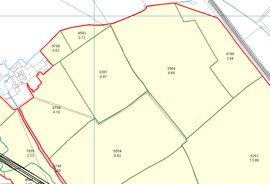
It’s taken us a little longer to get this in place, but PearGIS now provides land covers as well as field outlines. This means that when you load your RPA data, you’ll get a detailed breakdown of what each of the elements of land use are — be it an agricultural building, arable land, forestry, golf course, etc. This information comes in pre-styled, loading in as the information associated with your RPA account, formatted with the land covers. Each element features a field number, its area and its land use, and now also depicts hedgerow. There’s even a filter style to search by land type!
Parallel shapes tool
With this new tool, you can now easily depict multiple elements with parallel lines or shapes. We have provided automation so that after drawing a line or shape, you can ‘draw a parallel shape’, recreating the previous element. You can add numerous parallel shapes, rather than having to recreate the same element over and over. Great for, as an example, mapping field drainage !
Printing furniture saved between print preview sessions
Put in by popular demand! Now, when you add map furniture (e.g corporate branding, a legend, a scale line) to your print preview, this will all be saved to the print preview between sessions / until the map area is moved or edited. This means you can print, then go back and adjust the map furniture and reprint two days later, without having to place the furniture all over again.
Improved functionality between PearGIS, OS data and PocketGIS
The flow of handheld data capture between PearGIS and PocketGIS has been refined and improved for simplicity and automation, and is now fully supported and implemented. This means that getting the information from PearGIS onto your handheld for data capture is now fully available. All relevant Ordnance Survey data is now also able to be transferred between the two.
Edit multiple attribute values simultaneously
Here by popular demand! If you want to make the same change to multiple fields’ information, you can now make grouped changes rather than having to make each change individually and manually. This makes it much easier and less time consuming in practice when 20 fields need to be transferred into a completely new tenancy agreement!
Attribute value pre-sets and drop-down menu
When you are assigning information against an object, you previously had to manually type out each label. Instead, we have now created the option of a pre-set list (which you can add to and create new options to select from) so that the pre-set data is what you are choosing from, for speed and simplicity.
Improved alphanumerical data sorting
Yet another heavily requested feature! The identification of individual woodland sub compartments, for instance, are often made up of a combination of numbers and letters. The sorting feature has now been improved so that when organising or sorting this combined data, it is presented in an improved, more user-friendly way, sorting numerically or alphabetically and making it far easier to sort through and view data.
Merge existing data into PearGIS objects
Permanently copy linked data into PearGIS objects feature attributes. Merge existing data from other (non PearGIS) sources into the attributes of your PearGIS objects. Previously, you had to view your separate spreadsheet with all the individual information about the object. Now, you can load that data to be permanently assigned to the object within PearGIS, so that your synced data becomes visible within PearGIS when you click on the object. The option to still there, however, to keep the data as is, or linked to the map from external sources, if that is your preference.
Layer Templates
There is the ability to create layers based on a template now. So if you are making lots of individual maps manually, you might want the same layers in each map having the same styling etc. This can now be designed as a template to import into any map as needed; removing repetition, any human error, and giving you more time to work on what is important.
Automatic field numbering
Automatic field numbering can now be applied to all objects on a layer at once
Previously, this required manually clicking on each field at a time to add labelling — quite a big job if you have 200 fields to label! Now you can select a layer, choose to add field numbers to that layer, and update the whole layer. The layer then instantly updates, adding a number to all of the objects in the layer at once.
Two column legend in printing
You can now choose to display your map legend over more than one column when printing the map.
Biodiversity Net Gain survey templates
We have created survey templates for handheld data capture and PearGIS, based on the Biodiversity Net Gain Metric, saving you from having to try and manually design the same from scratch yourself. The survey now goes through each element that is required / needs to be captured, based on the biodiversity net gain metric,such as Broad Habitat Type, habitat type, distinctiveness, conditions, strategic significance, etc. An object on the map then has the captured information recorded against it.
Habitat Types can also be selected from a drop down list of options. This list is supplied by UKHab, as approved by the government for use within the Biodiversity Net Gain Metric.
Looking forwards with Pear Technology
We have big and exciting plans for the rest of the year! We want to enable easier access for colleagues within an organisation to be contributing, sharing feedback, viewing and discussing their mapping amongst their organisation. That means improving our functionality for online data sharing and collaboration between parties. We can’t say too much on this at the moment so, once again, stay tuned and keep an eye on our socials for updates throughout the year…


